To West Cork
And Mizen Head


May 17, 2025
We left our hotel in central Dublin and took a taxi to pick up a rental car. Luckily our suitcases just fit in the back of the car. The bright orange color ensured we would never lose it. We headed south from Dublin to the Wicklow Mountains, the largest national park in Ireland. We drove just over one hour to the Glendalough Visitors’ Center, where we parked the car.

This is the location of one of the most important monastic sites in Ireland. Before visiting the site, we watched an informative video that explained the origins of monastic life in Ireland from the 5/6th centuries. The Glendalough site was founded by St Kevin. We would note that Ireland has many saints whom we had never heard of before, and a great deal of religious and academic activity took place here in the period while the rest of Europe slept (i.e., the so-called Dark Ages). We then walked a short distance to the site, which has evocative cemetery with Celtic crosses, an old church, St Kevin’s “kitchen” and the highlight—the tallest surviving round tower in Ireland, over 100 feet tall.
After exploring the ruins, we walked a short distance to the lower of the two Glendalough lakes, with a beautiful view of the nearby mountains.


Here are several photos of Glendalough, and
below the lower lake.

We then returned to our car and drove through the park over the Wicklow Gap (they seem to use the term “Gap” to describe what we would call a summit or mountain pass). The drive up to the Gap and down the other side was filled with flowering trees and bushes. The bushes had yellow flowers and looked somewhat like Scotch Broom in California, but we later learned they were called “gorse”. The trees were big and filled with small, brilliant white flowers, and we never learned the name.
We stopped at a small village, Hollywood, for lunch, and then hooked up with an expressway to make our drive to our next destination less stressful. The total drive time today from Glendalough to Cashel, where we would spend the night, was about two hours.

Near the Wicklow Gap.
After checking in to our hotel and parking our car, we walked up a steep hill to the Rock of Cashel, a medieval castle/church beautifully perched on the hill with a 360-degree view. The Rock features the most impressive cluster of medieval buildings in Ireland. We took a one-hour tour of the site, where we learned about the history, including that St Patrick visited the site in the fifth century. He apparently got around. Although it was the seat of the kings of Munster as early as the 4th century, the height of the rock’s power dates from 977 when another king was crowned there. We couldn’t completely follow the convoluted back and forth after that time between two rival families who controlled the site for different intervals. The castle has another round tower from the 12th century (92 feet tall), as well as a ruined Gothic cathedral. The last place we visited on the tour was Cormac’s Chapel (1134). It has a few fragments of frescoes and elaborate carved decorations in the stone.


Above are several photos from the Rock of Cashel.
Cormac’s Chapel is next to the gothic bell tower, middle right photo.
Afterwards, we had a beer in a local Irish pub before having a nice dinner in a restaurant located in a former church.
May 18, 2025
We woke up to another beautiful sunny day. We are getting spoiled! We departed Cashel and drove south on the expressway to the outskirts of Ireland’s second most populous city, Cork. After buying gas for the car, we headed west on smaller roads but still roads that were fine for us to drive on. Our first stop, about two hours into the drive, was at the Drombeg Stone Circles (also known as The Druid Altar). These are from the Bronze Era and are about 3,000 years old. This was the first Neolithic site we’ve visited in Ireland. Here is a photo.

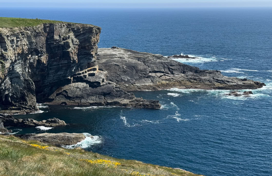
We then headed farther west, over increasingly narrow roads, through towns that got smaller the farther we drove. The land turned from manicured farmland to barren rocky hillsides, with many colorful rocky coves on the coast.


Photos of the West Cork coast. This viewpoint also featured a wedge tomb constructed between 3,000 and 2,000 B.C.
After having lunch in one of the small towns, we drove to the far southwest corner of Ireland, Mizen Head. This is the site of an old radio/signal station and lighthouse. We walked on paved paths with a suspension bridge over an amazing gorge with wonderful views of the Atlantic and fantastically shaped rocks. It is a really beautiful location and would turn out to be a highlight of our trip.


These three photos are of beaches near Barleycove, as we approached Mizen Head.
This photo is looking backwards from the visitor center near the beginning of the Mizen Head path.

Farther along, approaching the bridge which can be seen in the photo below.
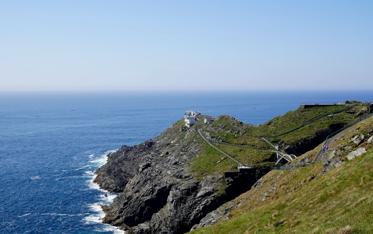

The bridge was surprisingly sturdy—didn’t bounce at all. The photos below were taken from the bridge.


The next photos are from the near the signal station.


The views were truly spectacular.
After spending an hour or so there, we turned around and took a route over the mountains to the north side of the Mizen peninsula and eventually reached the attractive port town of Bantry, where we spent the night.

Above, heading over the mountains to Bantry, shown below.

Here is a map of our drive from Dublin to Bantry via Glendalough, Cashel and Mizen Head.
Tomorow we are heading to the next county north, County Kerry.
